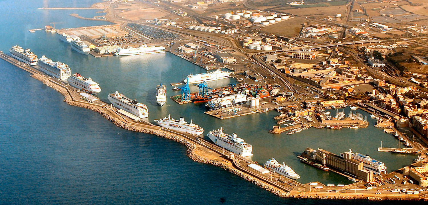
Preliminary design and environmental impact study of the Strategic Works for the Port of Civitavecchia. Preliminary Design for Strategic Works
Client: Port authority of Civitavecchia
Period of implementation: 2005/2006
Total value of works: Euro 211.006.881,00
Value of our services: Euro 294.641,72
The Planning Scheme of the Port of Civitavecchia has completed the procedure for verifying the environmental compatibility with Inter-Ministry Decree DVA-DEC-2010/0000004 of 09/02/2010 of the Ministry for the Environment and the Protection of the Territory and the Sea, together with the Ministry for the Cultural Heritage and Cultural Activities, and was definitively approved by Lazio Region with Resolution in GR no. 121 of 23/03/2012.
The drafting of the Port Planning Scheme of Civitavecchia began with the study of the current situation and the identification of the potentials of the infrastructure in the context of local and national traffic.
The Plan defines the following general aims:
- strengthening of the position of the port of Civitavecchia in the Tyrrhenian and relaunching of its presence in the economy of northern Lazio;
- coordination of seagoing traffic in relation to the other Lazio ports to construct an “effective and efficient” complex, to be obtained by the continuous comparison of tariff policy and operational results;
- increase of cabotage traffic.
The general aims were further expressed in the following specific aims:
- removal from the historic port of the commercial activities connected with seagoing traffic;
- preparation of specialized quays in the northern area of the port;
- identification of areas in the immediate hinterland to be dedicated to port auxiliary activities;
- functional reorganization of the port area;
- increase in terms of quantity and quality of the services offered to ferry and cruise ship passengers;
- increase in terms of quantity and quality of the services offered to maritime sector operators;
- relaunching of tourist and cultural activities of interest to the city by the recovery of the historic and cultural heritage of the historic port;
- improvement of connections with the hinterland.
In accordance with the aforesaid aims, the Plan provides for the following port configuration:
Commercial Port subdivided in the following territorial areas and districts
- ENEL area
- Shipbuilding area
- Darsena Energetica/Grandi Masse (Large Tanker Dock)
- Service Dock
- Productive area connected with port traffic
- Ferry Dock
- Hinge areas
- Commercial terminal
- Cruise ship terminal
- Trade Center Authority area
Historic port, having a configuration characterized by the subdivision of the port area into two zones: the Northern Zone, with the commercial harbour entirely dedicated to commercial activities; the Southern Zone, including the historic port, designated for recreational boating and hosting urban functions.
Environmental impact study
The Environmental Impact Study (EIS) associated with the Civitavecchia Port Planning Scheme is structured in three sections: Planning framework, Project framework and Environmental framework.
The Environmental framework shows the analysis of all the modifications to the environment produced by the construction of the works provided for in the Port Planning Scheme. In particular, the following environmental components, actually involved in the construction of the works and their ordinary functioning, were examined:
- Atmosphere
- Acoustic
- Soil, subsoil and water environment
- Land vegetation, flora, fauna and ecosystems
- Aquatic vegetation, flora, fauna and ecosystems
- Landscape
- Public health
Among the components covered by the Environmental Impact Study, the part regarding soil, subsoil and water environment was investigated in order to assess the interference that the planned works would produce on the local hydrology and geomorphology, with particular reference to the alteration of the morphological transformation processes and the balanced utilization of natural resources. With regard to the hydrologic and hydrographic features of the area affected by the port, surface drainage of rainwater in the area examined is provided by a series of trenches, generally of local importance, characterized by extended catchment basins, set orthogonally to the coastline. Among these, there are four that could interfere with the project elements; they serve limited size hydrographic basins coming fully within the municipality of Civitavecchia: Fosso di Torre Valdaliga, Fosso di Monna Felice, Fosso del Prete, Fosso della Fiumaretta.
Over the past ten years, the port area of Civitavecchia, has been extensively modified and extended, and therefore many geognostic studies have been conducted.
On the whole, we can say that the port area is characterized by the outcropping of Pleistocene sediments, generally with sand, silt and calcarenite, based on clay-silt strata, which are, in turn located on the underlying Flysch substrata. For this component, only transitory environmental impact was considered, connected with the transport from the quarry areas to the construction areas.


